Chile has always been an intriguing country, so long and so thin, stretching for over 4270kms from its border with Bolivia in the north to its tip on the bottom of the Americas and, on average, only 177kms east to west. For its entire length the mountain range of The Andes defines its geography and ecosystems. But the geo-political entirety of the country only came together in the 1880s, when Chile triumphed in the War of the Pacific and annexed Peru’s southern shoreline and Bolivia’s entire Pacific coast, so land-locking the latter country. At the same time, its troops conquered the indigenous Mapuche people and their land south of Santiago was subsumed into modern Chile.
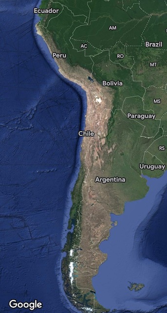
Down south, the region known as Patagonia is shared with Argentina, the Chilean side characterised by glacial fjords and temperate rainforest whilst it’s the Argentinian side of the Andes that has arid steppes and deserts. North of the squeezed middle with the cities of Santiago (See PC 89 Franco’s Santiago 2017) and Valparaiso lies one of the driest places on earth, the Atacama desert and to its north east lies the tourist town of San Pedro de Atacama.
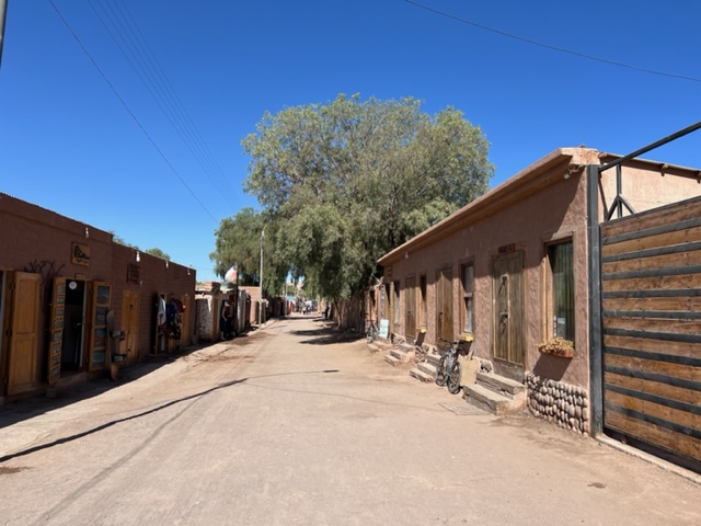
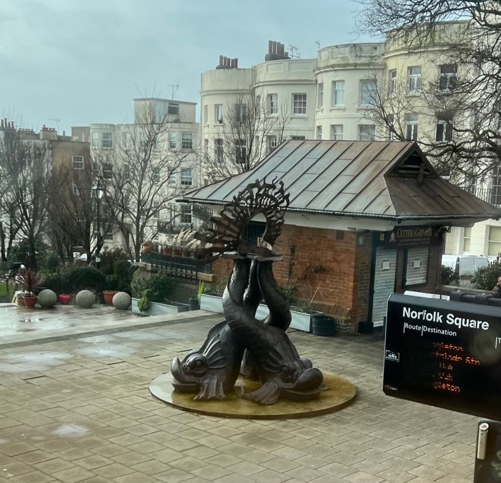
Main Street, San Pedro
Distinguished by the reddish colour of its clay buildings, it’s …. “a town set on a high plateau in the Andes mountains of north-eastern Chile. Its dramatic surrounding landscape incorporates desert, salt flats, volcanoes, geysers and hot springs. The Valle de la Luna nearby is a lunar-like depression.”
Enough of a basic geography lesson, or reminder (?) Why, you might ask, is this postcard seemingly from Latin America? As Covid travel restrictions eased, in November last year we planned to return to Rio de Janeiro and thought about ‘doing the Atacama and Patagonia’, such is the success of Chile’s tourism advertising; these two, plus Easter Island, have become the go-to destinations.
Luckily one of my Godsons is married to the co-founder of a UK travel agent who specialises in Latin America (www.latinroutes.co.uk). The first draft suggestions from Latin Routes covered both the Atacama and Patagonia. Scrutiny of the journey from the Atacama to Patagonia revealed an early start, two interconnecting flights and, after arriving in Punta Arenas Airport late in the day, a six hour trip in a 4×4 to the lodge. This would not have been a holiday so Patagonia will have to wait for another time!
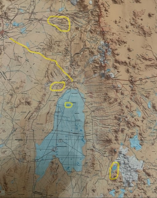
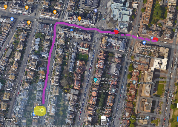
San Pedro in the centre, mountain lakes bottom right and Rainbow Valley due north
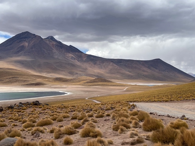
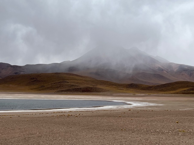
I hadn’t realised how much one might be affected by a change of altitude. Rio de Janeiro is, obviously, at sea level (doh!) and Santiago at 570m. We arrived in northern Chile and drove into San Pedro de Atacama, which lies at 2450m. Someone mentioned we might feel its effects but I can only describe it as walking across a swinging rope bridge, not quite sure where my next step would be and whether my legs were moving independently! On our first excursion we ended up at the mountain lakes of Miscanti and Miniques at 4150 metres.
Fortunately I was wearing a T shirt from the Dutch ‘Iceman’ Wim Hof with ‘Breathe …. Motherf***kers’ emblazoned across the chest! You needed to consciously breathe full breathes and take short steps.
For our first excursion our Trekana guide Mauricio had met us at our Noi Casa hotel and we joined Andrea and Andreas from Berlin and another couple from Madrid. We were staying in the same hotel as Andrea & Andreas and got to know them; we hope to keep in touch. We drove out to the large salt flats of Laguana Chaxa, the ‘Salar de Atacamas’, lying some 30 minutes south of San Pedro in the Los Flamencos National Reserve.
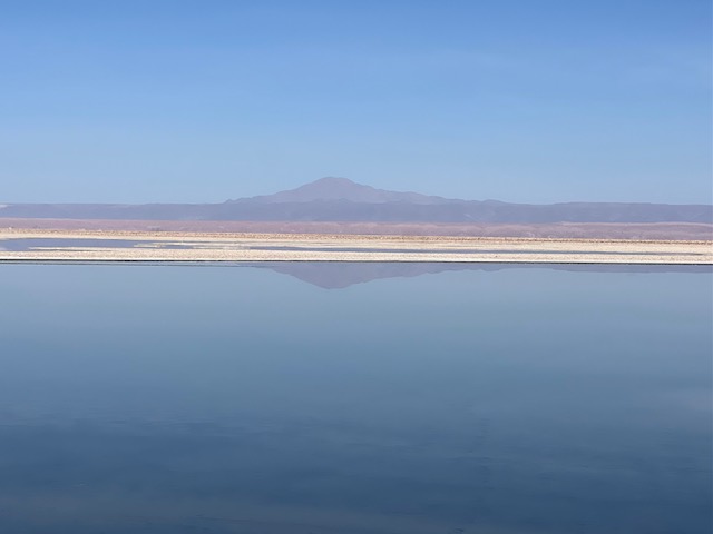
Actually ‘large’ is an inadequate word, as they extend some 150kms south, are 65kms wide and over a kilometre and a half deep. ‘Deep’ as in salt minerals; the surface water is only about 3 feet deep. (Note 2) The attraction here is the three species of flamingos, the Chilean, the Andean and the James’.

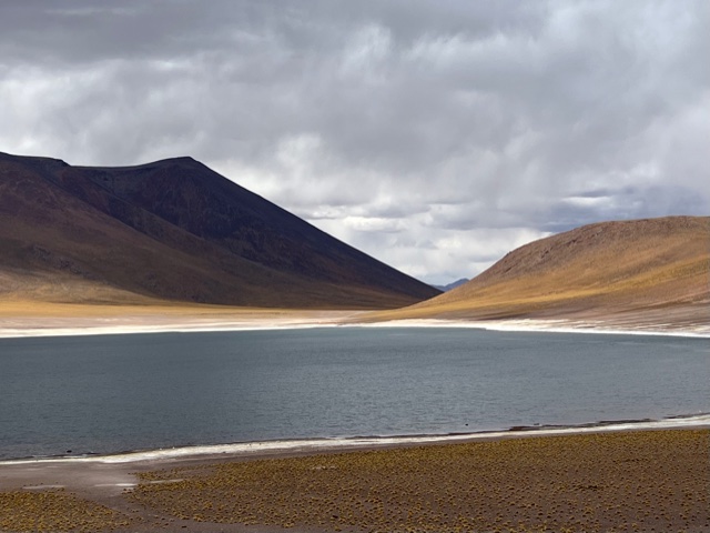
From there we went up into the mountains (see map), to those charming lakes of Miscanti and Miniques. It freezes hard up here in the winter but we were lucky with some sun, before a shower of rain. (Note 3)
We drove back towards San Pedro de Atacama and stopped for a picnic lunch at the junction of an old Inca trail and the Tropic of Capricorn (Note 4). Just a line on a map, this latitude of the ‘Tropic of Capricorn’, but walking out down the dusty Inca trail, away from everyone else, lovely to let one’s mind imagine the traffic this path had experienced thousands of years ago; footprints, sandal impressions, the hoof tracks of donkeys and llamas, but now simply dust.
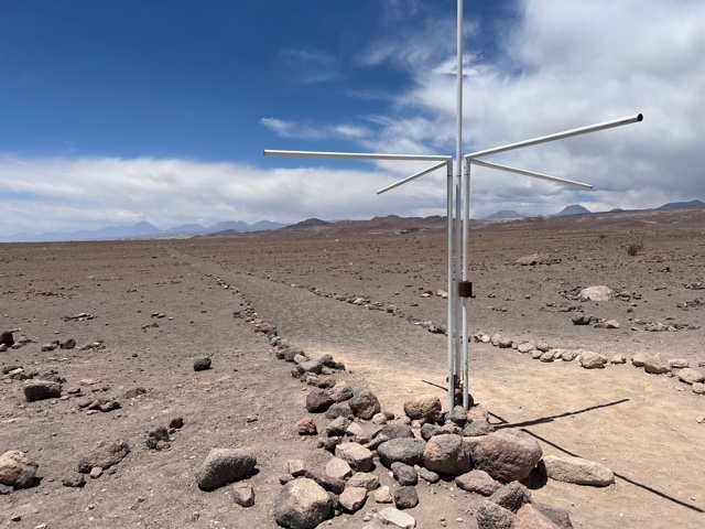
The Tropic of Capricorn crossing an ancient Inca trail moving off northwards
Part Two to follow next week.
Richard 27th January 2023
http://www.postcardscribbles.co.uk
PS As an aside, some of you will have read my postcards from our trip to the north of South Island New Zealand in 2020 (PCs 169 and 170), when I wanted to visit the sand spit where, in August 1877, a seventeen year old girl, who later became my great grandmother, was shipwrecked and rescued some days later. I needed a travel agent with very local knowledge of the area, so went onto Google Earth, zoomed into the town of Nelson and located a travel agent on Trafalgar Street, World Travellers. Then it was a simple task to ask by email whether they could do the international stuff in addition to the local detail. The result was absolutely perfect.
Note 1 Chile is the most prominent example of an elongated type of territorial morphology; other examples include Norway and Vietnam.
Note 2 Compare with the Pantanal, (see PC 17 and 20 2014) the world’s biggest wetland, some 800kms north to south, 500kms east to west, with a height difference of some one metre over its whole length. The Pantanal lies east over The Andes from The Atacama, straddling the borders of Brazil, Paraguay and Bolivia. Oddly they are at about the same latitude, one of the driest places on earth and one of the wettest; separated by the great mountain range of the Andes!
Note 3.Despite it being summer in the southern hemisphere, the months of January and February mark the Altiplanic winter here, with occasional heavy rain storms. Bizarre huh?
Note 4 Simon Reeve, a British author and travel documentary maker, made a fascinating journey along the Tropic of Cancer and along the Tropic of Capricorn. Among his other programmes is one entitled The Americas; the part about Chile is intriguing.